Broadford Park Business Park
Introduction
The photograph on this page of Broadford Park Business Park by Ian Capper as part of the Geograph project.
The Geograph project started in 2005 with the aim of publishing, organising and preserving representative images for every square kilometre of Great Britain, Ireland and the Isle of Man.

There are currently over 7.5m images from over 14,400 individuals and you can help contribute to the project by visiting https://www.geograph.org.uk
Broadford Park Business Park
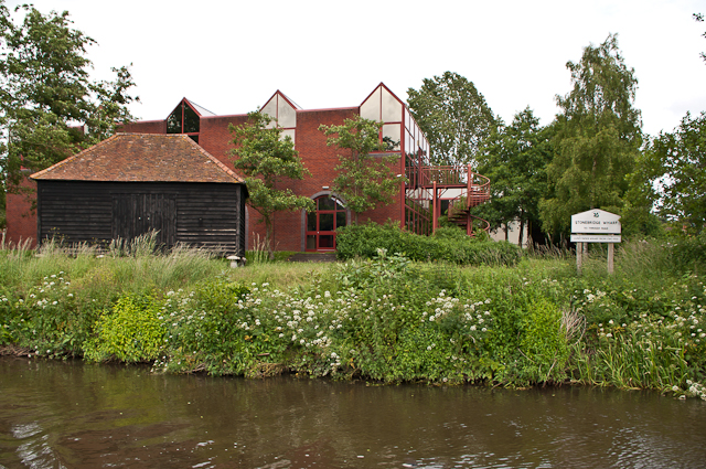
Image: © Ian Capper Taken: 23 Jun 2012
Business park alongside the River Wey. The board on the right states that this was Stonebridge Wharf, which served as a gunpowder wharf from 1764 to 1920, serving the nearby gunpowder works at Chilworth. The building on the left is one of the original stores, raised above the ground on staddle stones so as to keep the powder dry.
Images are licensed for reuse under creativecommons.org/licenses/by-sa/2.0
Image Location


Leaflet Map data © OpenStreetMap
Latitude
51.209844
Longitude
-0.572784