Oxford Canal: Bridge Number 52: Perkin's Bridge
Introduction
The photograph on this page of Oxford Canal: Bridge Number 52: Perkin's Bridge by Nigel Cox as part of the Geograph project.
The Geograph project started in 2005 with the aim of publishing, organising and preserving representative images for every square kilometre of Great Britain, Ireland and the Isle of Man.

There are currently over 7.5m images from over 14,400 individuals and you can help contribute to the project by visiting https://www.geograph.org.uk
Oxford Canal: Bridge Number 52: Perkin's Bridge
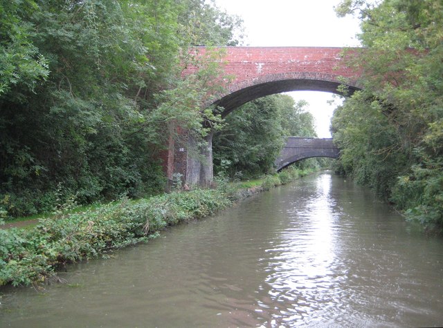
Image: © Nigel Cox Taken: 12 Sep 2012
The near, higher, bridge here is Perkin's Bridge which once provided a route over the canal to and from Glebe Farm, which was just on the north side to the right here. The farm was subsequently redeveloped into an industrial estate, and a new bridge to the east, behind the photographer, was built, carrying Consul Road into the estate. The far, lower, bridge carried the now dismantled former Midland Railway's Rugby to Leicester line over the canal.
Images are licensed for reuse under creativecommons.org/licenses/by-sa/2.0
Image Location
Latitude
52.389213
Longitude
-1.268637