Flooded caravan park, Topcliffe
Introduction
The photograph on this page of Flooded caravan park, Topcliffe by Gordon Hatton as part of the Geograph project.
The Geograph project started in 2005 with the aim of publishing, organising and preserving representative images for every square kilometre of Great Britain, Ireland and the Isle of Man.

There are currently over 7.5m images from over 14,400 individuals and you can help contribute to the project by visiting https://www.geograph.org.uk
Flooded caravan park, Topcliffe
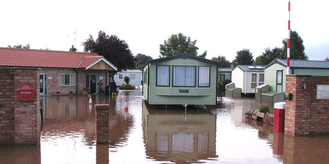
Image: © Gordon Hatton Taken: 26 Sep 2012
The flood of late September was record breaking as the Swale rose to its highest level in at least 30 years, flooding the caravan park and its recently constructed reception building, as well as the old toll cottage across the road and the lower floors of Topcliffe Mill a few hundred metres upstream. After this photo was taken the waters rose at least another 30cm.
Images are licensed for reuse under creativecommons.org/licenses/by-sa/2.0
Image Location
Latitude
54.177615
Longitude
-1.391126