Gateposts, Musbury House
Introduction
The photograph on this page of Gateposts, Musbury House by Derek Harper as part of the Geograph project.
The Geograph project started in 2005 with the aim of publishing, organising and preserving representative images for every square kilometre of Great Britain, Ireland and the Isle of Man.

There are currently over 7.5m images from over 14,400 individuals and you can help contribute to the project by visiting https://www.geograph.org.uk
Gateposts, Musbury House
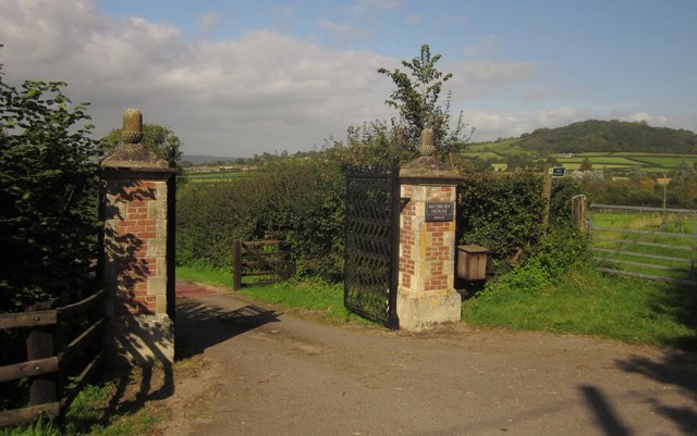
Image: © Derek Harper Taken: 15 Sep 2012
The listed building description for "Front Garden Area Railings and Piers south of Musbury House" describes the gate piers as "Brick end piers with stone quoins and caps with acorn finials" http://list.english-heritage.org.uk/resultsingle.aspx?uid=1169488&searchtype=mapsearch - that sounds like these, on the lane between Boshill Cross and Lower Bruckland. But the map reference - and the garden area railings - are some 230 metres away close to the house itself. Are there another pair of gate piers there? Anyway, these look fairly authentic. On the right is the start of Axmouth Footpath 16, discussed in Image the wooded hill in the background is Musbury Castle.
Images are licensed for reuse under creativecommons.org/licenses/by-sa/2.0
Image Location
Latitude
50.730373
Longitude
-3.037824