Corum Tower
Introduction
The photograph on this page of Corum Tower by Roger Templeman as part of the Geograph project.
The Geograph project started in 2005 with the aim of publishing, organising and preserving representative images for every square kilometre of Great Britain, Ireland and the Isle of Man.

There are currently over 7.5m images from over 14,400 individuals and you can help contribute to the project by visiting https://www.geograph.org.uk
Corum Tower
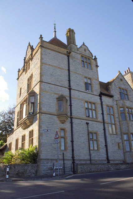
Image: © Roger Templeman Taken: 18 Sep 2012
The house is at the junction of Pound Road and Sidmouth Road. There is an OS benchmark Image on the corner of the building to the left of the Pound Road name sign. The vane is an OS intersected station trig point, http://www.trigpointinguk.com/trigs/trig-details.php?t=10412
Images are licensed for reuse under creativecommons.org/licenses/by-sa/2.0
Image Location
Latitude
50.724538
Longitude
-2.941215