Musbury
Introduction
The photograph on this page of Musbury by Derek Harper as part of the Geograph project.
The Geograph project started in 2005 with the aim of publishing, organising and preserving representative images for every square kilometre of Great Britain, Ireland and the Isle of Man.

There are currently over 7.5m images from over 14,400 individuals and you can help contribute to the project by visiting https://www.geograph.org.uk
Musbury
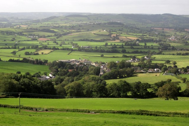
Image: © Derek Harper Taken: 15 Sep 2012
The village seen from Musbury Footpath 32 along the crest of the scarp slope, with the Axe valley beyond. In the middle distance on the right is Whitford, and over the wooded knoll of Langdown Plantation is the Umborne Brook valley.
Images are licensed for reuse under creativecommons.org/licenses/by-sa/2.0
Image Location
Latitude
50.74556
Longitude
-3.028947