Dorstone church viewed from the SW
Introduction
The photograph on this page of Dorstone church viewed from the SW by Jaggery as part of the Geograph project.
The Geograph project started in 2005 with the aim of publishing, organising and preserving representative images for every square kilometre of Great Britain, Ireland and the Isle of Man.

There are currently over 7.5m images from over 14,400 individuals and you can help contribute to the project by visiting https://www.geograph.org.uk
Dorstone church viewed from the SW
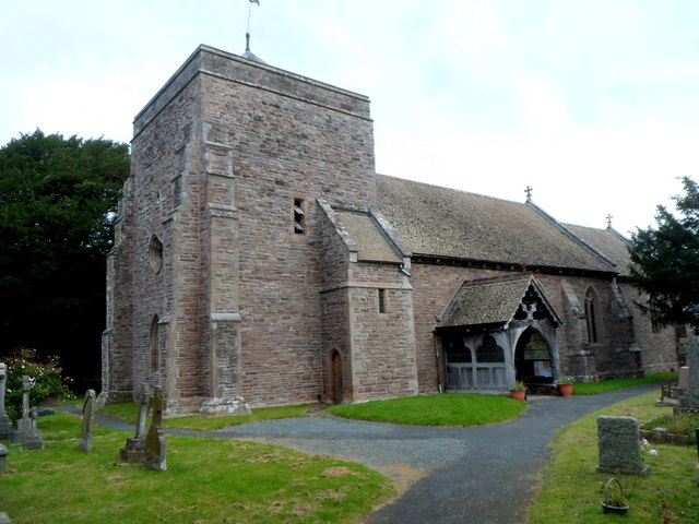
Image: © Jaggery Taken: 16 Sep 2012
St Faith's Church Dorstone is one of eight churches in the Church of England Borderlink Group of parishes. This church is the fourth one to occupy this site. The first one was built in the 12th century. The second one was a chapel founded in 1256. This one survived until 1827. The third church lasted only 60 years because of poor construction. The current church, in the Early English style, dates from 1889.
Images are licensed for reuse under creativecommons.org/licenses/by-sa/2.0
Image Location
Latitude
52.07022
Longitude
-3.001205