Coventry Canal: Bridge Number 19: Wharf Inn Bridge
Introduction
The photograph on this page of Coventry Canal: Bridge Number 19: Wharf Inn Bridge by Nigel Cox as part of the Geograph project.
The Geograph project started in 2005 with the aim of publishing, organising and preserving representative images for every square kilometre of Great Britain, Ireland and the Isle of Man.

There are currently over 7.5m images from over 14,400 individuals and you can help contribute to the project by visiting https://www.geograph.org.uk
Coventry Canal: Bridge Number 19: Wharf Inn Bridge
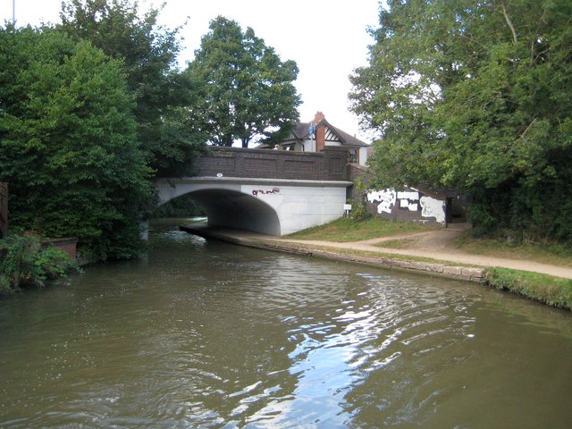
Image: © Nigel Cox Taken: 11 Sep 2012
The 1888 Ordnance Survey map shows the "Old Wharf Inn" to the left of the bridge with the wharf on the left too. The inn has now gone and the bridge now carries the B4113 Coventry Road over the canal. Incidentally looking at Google Street View (June 2009 imagery) to check the current status of the inn showed a police mobile speed camera enforcement van parked up on the bridge...
Images are licensed for reuse under creativecommons.org/licenses/by-sa/2.0
Image Location
Latitude
52.510922
Longitude
-1.467305