Catterick Bridge station (remains), 1988
Introduction
The photograph on this page of Catterick Bridge station (remains), 1988 by Ben Brooksbank as part of the Geograph project.
The Geograph project started in 2005 with the aim of publishing, organising and preserving representative images for every square kilometre of Great Britain, Ireland and the Isle of Man.

There are currently over 7.5m images from over 14,400 individuals and you can help contribute to the project by visiting https://www.geograph.org.uk
Catterick Bridge station (remains), 1988
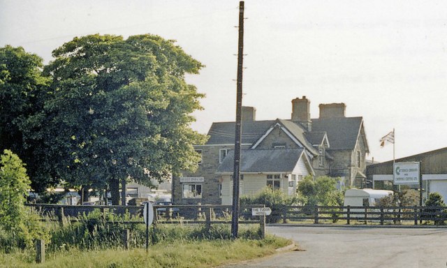
Image: © Ben Brooksbank Taken: 23 Jun 1988
View westward, towards Richmond: ex-NER (Darlington) - Eryholme Junction - Richmond line. The station, also the Catterick Military Railway which branched off to the SW, served the vast Military Camp - the largest of the British Army, with 12,000 men - and therefore important, even after World War Two, the branch seeing regular Troop and Leave trains. However, it and the line to Richmond were closed to passengers from 3/3/1969 and to goods from 9/2/1970. The track, now a roadway, was lifted in October 1970 (the Goods Yard was the scene of a major explosion of ammunition in February 1944).
Images are licensed for reuse under creativecommons.org/licenses/by-sa/2.0
Image Location
Latitude
54.395342
Longitude
-1.654972