Dorset Square, Marylebone
Introduction
The photograph on this page of Dorset Square, Marylebone by Stephen McKay as part of the Geograph project.
The Geograph project started in 2005 with the aim of publishing, organising and preserving representative images for every square kilometre of Great Britain, Ireland and the Isle of Man.

There are currently over 7.5m images from over 14,400 individuals and you can help contribute to the project by visiting https://www.geograph.org.uk
Dorset Square, Marylebone
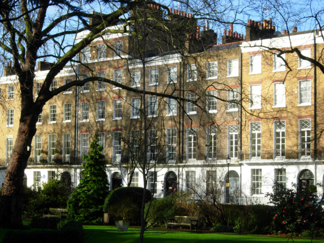
Image: © Stephen McKay Taken: 17 Jan 2007
This attractive square, between Gloucester Place and Marylebone Station, was the site of the original Lord's cricket ground, established here in 1787 by Thomas Lord. The cricket later moved out to its present home in St John's Wood, but the Marylebone connection is remembered in the MCC (Marylebone Cricket Club) name. The square is named after the Duke of Dorset, a patron of cricket.
Images are licensed for reuse under creativecommons.org/licenses/by-sa/2.0
Image Location
Latitude
51.523207
Longitude
-0.160721