Sampson Road Wharf near Sparkbrook, Birmingham
Introduction
The photograph on this page of Sampson Road Wharf near Sparkbrook, Birmingham by Roger D Kidd as part of the Geograph project.
The Geograph project started in 2005 with the aim of publishing, organising and preserving representative images for every square kilometre of Great Britain, Ireland and the Isle of Man.

There are currently over 7.5m images from over 14,400 individuals and you can help contribute to the project by visiting https://www.geograph.org.uk
Sampson Road Wharf near Sparkbrook, Birmingham
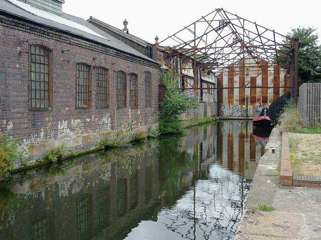
Image: © Roger D Kidd Taken: 21 Aug 2012
The short arm adjacent to Camp Hill Top Lock, and the nearby warehouses were formerly a depot for the Warwick and Birmingham Canal. This was the northern limit for wider boats, traffic continuing to Birmingham being limited to a beam of seven feet. Currently the venue is used by a modern boat crew's sanitary station (off to the right). This cannot be accessed from the towpath side of the canal or the lock itself. Image]
Images are licensed for reuse under creativecommons.org/licenses/by-sa/2.0
Image Location
Latitude
52.468893
Longitude
-1.874744