Galashiels Golf Course
Introduction
The photograph on this page of Galashiels Golf Course by Walter Baxter as part of the Geograph project.
The Geograph project started in 2005 with the aim of publishing, organising and preserving representative images for every square kilometre of Great Britain, Ireland and the Isle of Man.

There are currently over 7.5m images from over 14,400 individuals and you can help contribute to the project by visiting https://www.geograph.org.uk
Galashiels Golf Course
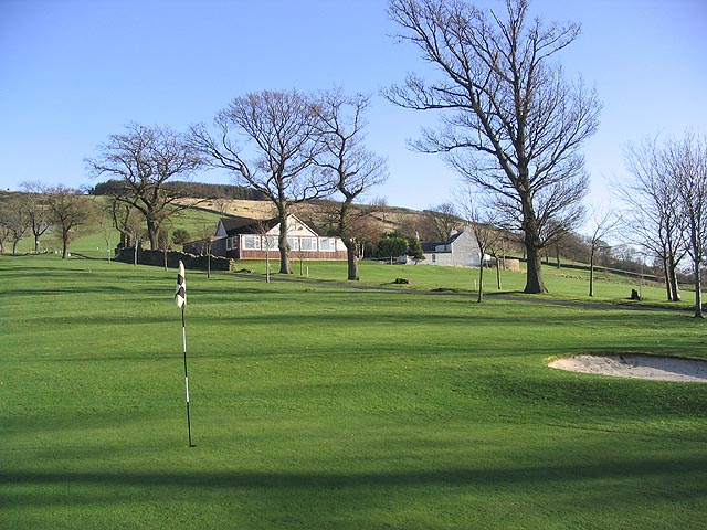
Image: © Walter Baxter Taken: 16 Jan 2007
Looking back from the 1st green to the clubhouse with Appletreeleaves house to the right. When the course was a municipal layout run by the then local town council, the greenkeeper lived in this house, but nowadays it is a private house. To the left of the clubhouse, hidden by some trees, are the late 16th century remains of Appletreeleaves Tower. Update on Galashiels Golf Course:- As from Sunday 2nd March 2008, the course ceased to be an 18 hole layout and has been reduced to 9 holes. As a result this hole will no longer be an official part of the course and will likely be used as practice facilities. For a full explanation of the move to 9 holes, see Image
Images are licensed for reuse under creativecommons.org/licenses/by-sa/2.0
Image Location
Latitude
55.620962
Longitude
-2.80597