The 1st green at Galashiels Golf Course
Introduction
The photograph on this page of The 1st green at Galashiels Golf Course by Walter Baxter as part of the Geograph project.
The Geograph project started in 2005 with the aim of publishing, organising and preserving representative images for every square kilometre of Great Britain, Ireland and the Isle of Man.

There are currently over 7.5m images from over 14,400 individuals and you can help contribute to the project by visiting https://www.geograph.org.uk
The 1st green at Galashiels Golf Course
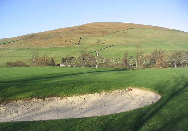
Image: © Walter Baxter Taken: 16 Jan 2007
A view towards Buckholm Hill. The 1st hole used to be a par 4, but was shortened to a par 3 and a new green built after a housing developer bought some adjacent fields to the old green. Concerns were raised about golf balls entering the new housing scheme, and this caused a lengthy debate at the time, but the developer won the day and the hole was shortened. Update on Galashiels Golf Course:- As from Sunday 2nd March 2008, the course ceased to be an 18 hole layout and has been reduced to 9 holes. As a result this hole will no longer be a part of the official layout but will likely be kept as a practice facilities. For a full explanation of the move to 9 holes, see Image
Images are licensed for reuse under creativecommons.org/licenses/by-sa/2.0
Image Location
Latitude
55.620962
Longitude
-2.80597