Kitcat, way to The Gatherums
Introduction
The photograph on this page of Kitcat, way to The Gatherums by Chris as part of the Geograph project.
The Geograph project started in 2005 with the aim of publishing, organising and preserving representative images for every square kilometre of Great Britain, Ireland and the Isle of Man.

There are currently over 7.5m images from over 14,400 individuals and you can help contribute to the project by visiting https://www.geograph.org.uk
Kitcat, way to The Gatherums
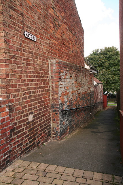
Image: © Chris Taken: 22 Sep 2012
This is one of three narrow, steep walkways that lead down to "The Gatherums", which is a park aligned with a path from Church St. to Aswell St. I understand it was named quite recently in memory of Kit Cat Lane, which ran past the end of it. I suspect the name has the same origins as "Kidgate". Names were given to each of the three alleyways leading into the Gatherums in order to indicate to people that they were public thoroughfares and not private entrances. See also: Image; Image
Images are licensed for reuse under creativecommons.org/licenses/by-sa/2.0
Image Location
Latitude
53.365551
Longitude
-0.001472