Great North Forest Trail at Hazard Lane, East Rainton
Introduction
The photograph on this page of Great North Forest Trail at Hazard Lane, East Rainton by Oliver Dixon as part of the Geograph project.
The Geograph project started in 2005 with the aim of publishing, organising and preserving representative images for every square kilometre of Great Britain, Ireland and the Isle of Man.

There are currently over 7.5m images from over 14,400 individuals and you can help contribute to the project by visiting https://www.geograph.org.uk
Great North Forest Trail at Hazard Lane, East Rainton
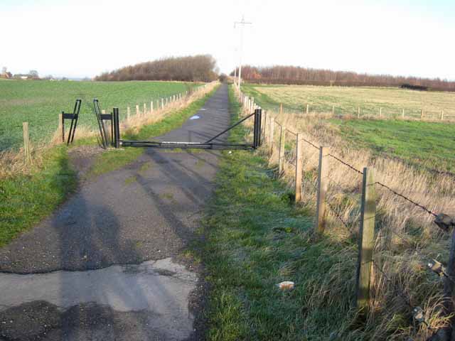
Image: © Oliver Dixon Taken: 16 Jan 2007
The Great North Forest is a long term government-backed project (inaugurated in 1990) to restore and revitalise the countryside round the towns of the north-east. http://www.necf.org.uk/index.php?pageId=8 The Great North Forest Trail is a 105Km circular trail which links up many parts of this geographically fragmented scheme. This section runs on what was probably the line of an old railway. Note the cycle "A" frame access control and the very low gate which horses can step over but which hopefully present an insuperable obstacle to motor bikes.
Images are licensed for reuse under creativecommons.org/licenses/by-sa/2.0
Image Location
Latitude
54.8212
Longitude
-1.472377