Old milestone at Rhu
Introduction
The photograph on this page of Old milestone at Rhu by Lairich Rig as part of the Geograph project.
The Geograph project started in 2005 with the aim of publishing, organising and preserving representative images for every square kilometre of Great Britain, Ireland and the Isle of Man.

There are currently over 7.5m images from over 14,400 individuals and you can help contribute to the project by visiting https://www.geograph.org.uk
Old milestone at Rhu
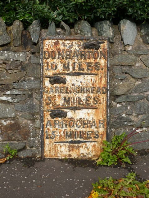
Image: © Lairich Rig Taken: 12 Sep 2012
The stone is set in a wall next to a bus stop on Image (see that photograph for context). The milestone is an old one; it is shown, at or near its present position, on the first-edition OS map (surveyed in 1860). "Dunbarton 10 miles / Garelochhead 5½ miles / Arrochar 15½ miles" The spelling "Dunbarton" is one that was favoured by the Trustees of Turnpike Roads (for reasons that are explained in Image). Compare Image
Images are licensed for reuse under creativecommons.org/licenses/by-sa/2.0
Image Location
Latitude
56.013765
Longitude
-4.771623