South Acton Station
Introduction
The photograph on this page of South Acton Station by Dr Neil Clifton as part of the Geograph project.
The Geograph project started in 2005 with the aim of publishing, organising and preserving representative images for every square kilometre of Great Britain, Ireland and the Isle of Man.

There are currently over 7.5m images from over 14,400 individuals and you can help contribute to the project by visiting https://www.geograph.org.uk
South Acton Station
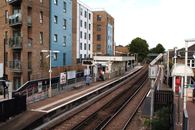
Image: © Dr Neil Clifton Taken: 19 Sep 2012
Looking northeast. This station has Overground trains to Stratford, and in the other direction to Richmond. Until 1959, another platform adjoined at the left, where the block of flats is now, which had a shuttle service of a single car to and from Acton Town, on the Piccadilly and District lines. But like other short but interesting branches of London Transport railways (Aldwych Branch and the Epping to Ongar line) it was closed in the interests of economy, and the track-bed was quickly built over.
Images are licensed for reuse under creativecommons.org/licenses/by-sa/2.0
Image Location
Latitude
51.499514
Longitude
-0.270164