The Newry River. Newry
Introduction
The photograph on this page of The Newry River. Newry by Albert Bridge as part of the Geograph project.
The Geograph project started in 2005 with the aim of publishing, organising and preserving representative images for every square kilometre of Great Britain, Ireland and the Isle of Man.

There are currently over 7.5m images from over 14,400 individuals and you can help contribute to the project by visiting https://www.geograph.org.uk
The Newry River. Newry
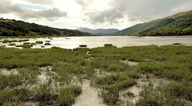
Image: © Albert Bridge Taken: 19 Sep 2012
Salt marsh (foreground) and the tidal Newry River, looking downstream towards Narrow Water and Warrenpoint, with the Cooley Mountains (Co Louth) in the background. The view is from this floodbank Image about 2¼ hours before high water at the Victoria Lock.
Images are licensed for reuse under creativecommons.org/licenses/by-sa/2.0
Image Location
Latitude
54.148835
Longitude
-6.320483