Smeaton's Arches, commemorative plaque
Introduction
The photograph on this page of Smeaton's Arches, commemorative plaque by Alan Murray-Rust as part of the Geograph project.
The Geograph project started in 2005 with the aim of publishing, organising and preserving representative images for every square kilometre of Great Britain, Ireland and the Isle of Man.

There are currently over 7.5m images from over 14,400 individuals and you can help contribute to the project by visiting https://www.geograph.org.uk
Smeaton's Arches, commemorative plaque
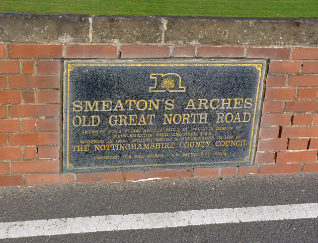
Image: © Alan Murray-Rust Taken: 14 Sep 2012
This records the various stages of rebuild and refurbishment. It gives the date of the later widening as 1929, but the English Heritage listings give the date as 1922, and certainly this was the date of Muskham Bridge.
Images are licensed for reuse under creativecommons.org/licenses/by-sa/2.0
Image Location
Latitude
53.095668
Longitude
-0.824677