Brown Knowl Methodist Church
Introduction
The photograph on this page of Brown Knowl Methodist Church by Jeff Buck as part of the Geograph project.
The Geograph project started in 2005 with the aim of publishing, organising and preserving representative images for every square kilometre of Great Britain, Ireland and the Isle of Man.

There are currently over 7.5m images from over 14,400 individuals and you can help contribute to the project by visiting https://www.geograph.org.uk
Brown Knowl Methodist Church
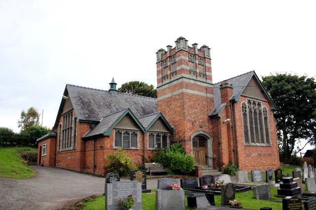
Image: © Jeff Buck Taken: 17 Sep 2012
Brown Knowl Methodist Church is located in Sherrington's Lane and has been designated by English Heritage as a Grade II listed building. The church was built in 1913 to replace an earlier Primitive Methodist chapel of 1836 that was located nearby. In the churchyard is the tomb, dating from about 1869, of John Wedgwood and his wife. John Wedgwood was a local preacher who did much to promote Primitive Methodism locally, and was a distant relative of Josiah Wedgwood. The tomb is listed at Grade II. Wikipedia http://en.wikipedia.org/wiki/Brown_Knowl_Methodist_Church
Images are licensed for reuse under creativecommons.org/licenses/by-sa/2.0
Image Location
Latitude
53.07678
Longitude
-2.754818