Keld Chapel
Introduction
The photograph on this page of Keld Chapel by Martin Dawes as part of the Geograph project.
The Geograph project started in 2005 with the aim of publishing, organising and preserving representative images for every square kilometre of Great Britain, Ireland and the Isle of Man.

There are currently over 7.5m images from over 14,400 individuals and you can help contribute to the project by visiting https://www.geograph.org.uk
Keld Chapel
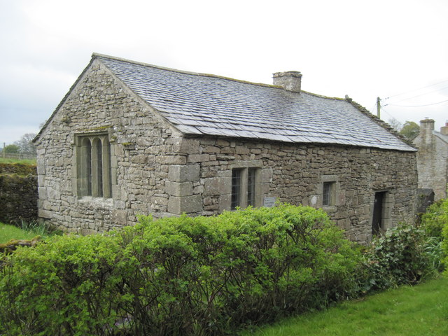
Image: © Martin Dawes Taken: 17 May 2012
Pevsner states that it is "plain and oblong, probably 16th century". In the care of the National Trust, the key at the cottage opposite.
Images are licensed for reuse under creativecommons.org/licenses/by-sa/2.0
Image Location
Latitude
54.523809
Longitude
-2.691196