Levels and Lines
Introduction
The photograph on this page of Levels and Lines by Des Blenkinsopp as part of the Geograph project.
The Geograph project started in 2005 with the aim of publishing, organising and preserving representative images for every square kilometre of Great Britain, Ireland and the Isle of Man.

There are currently over 7.5m images from over 14,400 individuals and you can help contribute to the project by visiting https://www.geograph.org.uk
Levels and Lines
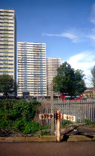
Image: © Des Blenkinsopp Taken: 13 Sep 2012
Ponders End Station. The train stopped just here, and I thought this looked like a bit of a picture so I snapped it without even leaving my seat. Slightly fuzzy due to railway glass, but not too bad. Nigel Cox has done all the work and named the tower blocks, which are in the next square west, so here's his pic with info. Image
Images are licensed for reuse under creativecommons.org/licenses/by-sa/2.0
Image Location
Latitude
51.643108
Longitude
-0.035044