Front elevation of Gardyne's Land
Introduction
The photograph on this page of Front elevation of Gardyne's Land by Douglas Nelson as part of the Geograph project.
The Geograph project started in 2005 with the aim of publishing, organising and preserving representative images for every square kilometre of Great Britain, Ireland and the Isle of Man.

There are currently over 7.5m images from over 14,400 individuals and you can help contribute to the project by visiting https://www.geograph.org.uk
Front elevation of Gardyne's Land
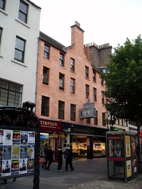
Image: © Douglas Nelson Taken: 13 Sep 2012
Gardyne’s Land is a complex of five historic buildings in the High Street of Dundee. At the heart of the site is a tower house, the only surviving example of a 16th century Merchant’s House in the city. The property has been restored and is now a backpackers’ hostel. The top floor of the 1640 tenement building has evidence of use by former inhabitants including W Fergus, Watchmaker, and McLeod, Bagpipe Maker.
Images are licensed for reuse under creativecommons.org/licenses/by-sa/2.0
Image Location
Latitude
56.460869
Longitude
-2.970051