Prospect Street and The Pheasant Inn
Introduction
The photograph on this page of Prospect Street and The Pheasant Inn by John Sutton as part of the Geograph project.
The Geograph project started in 2005 with the aim of publishing, organising and preserving representative images for every square kilometre of Great Britain, Ireland and the Isle of Man.

There are currently over 7.5m images from over 14,400 individuals and you can help contribute to the project by visiting https://www.geograph.org.uk
Prospect Street and The Pheasant Inn
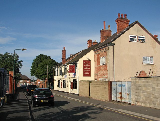
Image: © John Sutton Taken: 13 Sep 2012
Prospect Street runs between Radford Boulevard and Churchfield Lane. The Pheasant predates the late Victorian streets nearby. It was once in the shadow of Player's Castle Tobacco Factory, now demolished and the site of Castle Retail Park (behind the railings on the left).
Images are licensed for reuse under creativecommons.org/licenses/by-sa/2.0
Image Location
Latitude
52.961996
Longitude
-1.17832