Commemoration Plate, Conquest Hospital
Introduction
The photograph on this page of Commemoration Plate, Conquest Hospital by Julian P Guffogg as part of the Geograph project.
The Geograph project started in 2005 with the aim of publishing, organising and preserving representative images for every square kilometre of Great Britain, Ireland and the Isle of Man.

There are currently over 7.5m images from over 14,400 individuals and you can help contribute to the project by visiting https://www.geograph.org.uk
Commemoration Plate, Conquest Hospital
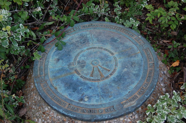
Image: © Julian P Guffogg Taken: 15 Sep 2012
Commemorating the start of work on the new "District General Hospital". The name Conquest was decided by a competition. Height above ordnance datum is given as 104.26m. The axis of the Hospital is built along the inscribed line several degrees off West-East.
Images are licensed for reuse under creativecommons.org/licenses/by-sa/2.0
Image Location


Leaflet Map data © OpenStreetMap
Latitude
50.885758
Longitude
0.56534