Westward from the bridge at Castle Donington & Shardlow
Introduction
The photograph on this page of Westward from the bridge at Castle Donington & Shardlow by Ben Brooksbank as part of the Geograph project.
The Geograph project started in 2005 with the aim of publishing, organising and preserving representative images for every square kilometre of Great Britain, Ireland and the Isle of Man.

There are currently over 7.5m images from over 14,400 individuals and you can help contribute to the project by visiting https://www.geograph.org.uk
Westward from the bridge at Castle Donington & Shardlow
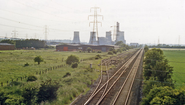
Image: © Ben Brooksbank Taken: 7 Jun 1988
View towards Stenson Junction and Burton-on-Trent: ex-Midland Trent (Sheet Stores Junction) - Stenson Junction (Burton-on-Trent) loop line. In the distance is Castle Donington Power Station, which closed eventually in 1994. (See also Image]).
Images are licensed for reuse under creativecommons.org/licenses/by-sa/2.0
Image Location
Latitude
52.852497
Longitude
-1.335424