Tunstall Court, Sittingbourne
Introduction
The photograph on this page of Tunstall Court, Sittingbourne by David Anstiss as part of the Geograph project.
The Geograph project started in 2005 with the aim of publishing, organising and preserving representative images for every square kilometre of Great Britain, Ireland and the Isle of Man.

There are currently over 7.5m images from over 14,400 individuals and you can help contribute to the project by visiting https://www.geograph.org.uk
Tunstall Court, Sittingbourne
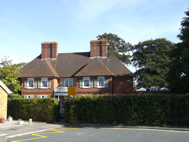
Image: © David Anstiss Taken: 6 Sep 2012
Large Grade II listed building at the end of Weald Court. See http://www.britishlistedbuildings.co.uk/en-175811-tunstall-court-kent for more details about the building. House is now used as part of a nearby primary school.
Images are licensed for reuse under creativecommons.org/licenses/by-sa/2.0
Image Location
Latitude
51.332192
Longitude
0.725717