End of the line
Introduction
The photograph on this page of End of the line by don cload as part of the Geograph project.
The Geograph project started in 2005 with the aim of publishing, organising and preserving representative images for every square kilometre of Great Britain, Ireland and the Isle of Man.

There are currently over 7.5m images from over 14,400 individuals and you can help contribute to the project by visiting https://www.geograph.org.uk
End of the line
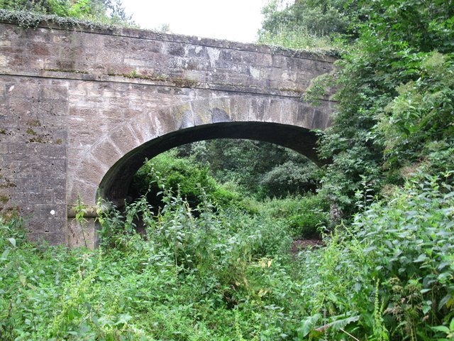
Image: © don cload Taken: 20 Aug 2012
Although most of the old railway line from Grantown to Forres is used by the Dava Way footpath, here, the last bridge before Forres, the old track is overgrown. After this it is very difficult to see where the track went onwards to Forres station.
Images are licensed for reuse under creativecommons.org/licenses/by-sa/2.0
Image Location
Latitude
57.599769
Longitude
-3.616131