Half lock, Thames Young Mariners base
Introduction
The photograph on this page of Half lock, Thames Young Mariners base by Robin Webster as part of the Geograph project.
The Geograph project started in 2005 with the aim of publishing, organising and preserving representative images for every square kilometre of Great Britain, Ireland and the Isle of Man.

There are currently over 7.5m images from over 14,400 individuals and you can help contribute to the project by visiting https://www.geograph.org.uk
Half lock, Thames Young Mariners base
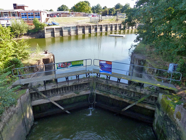
Image: © Robin Webster Taken: 9 Sep 2012
This was formerly a full pound lock for barge access to gravel workings at any state of the tide. It seems to have been built in about the 1920s. The lower gates have now been removed, leaving only these upper gates, and so restricting any navigation to when the tide makes a level, and when the cable between the two gates is removed.
Images are licensed for reuse under creativecommons.org/licenses/by-sa/2.0
Image Location
Latitude
51.437954
Longitude
-0.328604