Gisburn: Coal Pit Lane
Introduction
The photograph on this page of Gisburn: Coal Pit Lane by Dr Neil Clifton as part of the Geograph project.
The Geograph project started in 2005 with the aim of publishing, organising and preserving representative images for every square kilometre of Great Britain, Ireland and the Isle of Man.

There are currently over 7.5m images from over 14,400 individuals and you can help contribute to the project by visiting https://www.geograph.org.uk
Gisburn: Coal Pit Lane
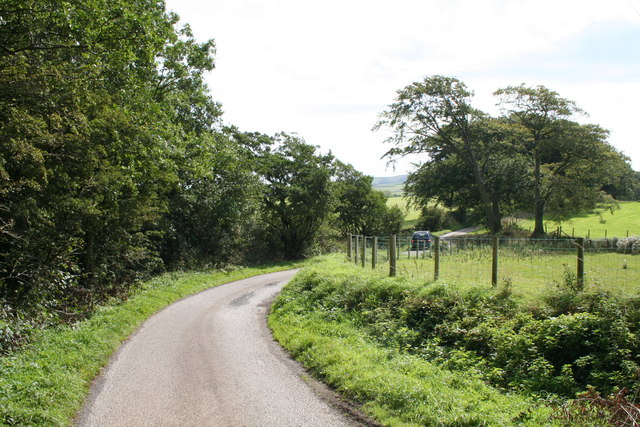
Image: © Dr Neil Clifton Taken: 9 Sep 2012
Looking southeast. Coal Pit Lane was once part of the ancient route from Gisburn to Colne. It joined up with Gisburn Old Road near the top of Weets Hill. However, the connection is no longer possible, as Coal Pit Lane ceases to be metalled in another 500 yards at Bonny Blacks Farm, and although bridleway rights exist further on, eventually the way becomes quite impassable, even for a pedestrian. As it is not a through road, there is very little traffic along Coal Pit Lane, (even Bonny Blacks can be reached much more easily by a different route).
Images are licensed for reuse under creativecommons.org/licenses/by-sa/2.0
Image Location


Leaflet Map data © OpenStreetMap
Latitude
53.923837
Longitude
-2.243755