Eastwood, Beauvale - NG16
Introduction
The photograph on this page of Eastwood, Beauvale - NG16 by David Hallam-Jones as part of the Geograph project.
The Geograph project started in 2005 with the aim of publishing, organising and preserving representative images for every square kilometre of Great Britain, Ireland and the Isle of Man.

There are currently over 7.5m images from over 14,400 individuals and you can help contribute to the project by visiting https://www.geograph.org.uk
Eastwood, Beauvale - NG16
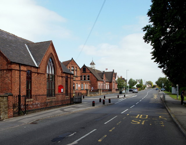
Image: © David Hallam-Jones Taken: 7 Sep 2012
Beauvale Methodist Church on one side of Mill Road and the former Greaseley Beauvale D.H. Lawrence Primary School on the other side of the road that branches off this one, Dovecote Road (A6010). D.H. Lawrence attended Beauvale Board School between 1891-98, becoming the first local pupil to win a County Council scholarship to Nottingham High School. The wing of the school seen here to the right of the school's central hub was once the "Girls' Section". This main road is Beauvale (the A6010). The school was renamed in Lawrence's honour but is now closed for educational purposes.
Images are licensed for reuse under creativecommons.org/licenses/by-sa/2.0
Image Location
Latitude
53.017269
Longitude
-1.288027