Cottam's Yard
Introduction
The photograph on this page of Cottam's Yard by Alan Murray-Rust as part of the Geograph project.
The Geograph project started in 2005 with the aim of publishing, organising and preserving representative images for every square kilometre of Great Britain, Ireland and the Isle of Man.

There are currently over 7.5m images from over 14,400 individuals and you can help contribute to the project by visiting https://www.geograph.org.uk
Cottam's Yard
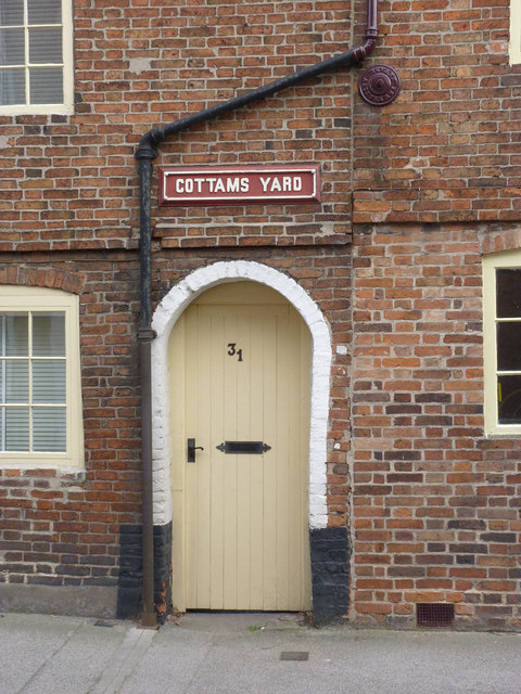
Image: © Alan Murray-Rust Taken: 31 Aug 2012
This would have provided access to a narrow yard, not more than about 10 feet wide, with several dwellings giving on to it. Yards like these represented the worst of the slums that mid-20th century slum clearance programmes set out to eradicate. The space now often provides a decent back garden for the main house fronting the street.
Images are licensed for reuse under creativecommons.org/licenses/by-sa/2.0
Image Location
Latitude
53.074988
Longitude
-0.815239