Council HQ, Thornbury
Introduction
The photograph on this page of Council HQ, Thornbury by Jaggery as part of the Geograph project.
The Geograph project started in 2005 with the aim of publishing, organising and preserving representative images for every square kilometre of Great Britain, Ireland and the Isle of Man.

There are currently over 7.5m images from over 14,400 individuals and you can help contribute to the project by visiting https://www.geograph.org.uk
Council HQ, Thornbury
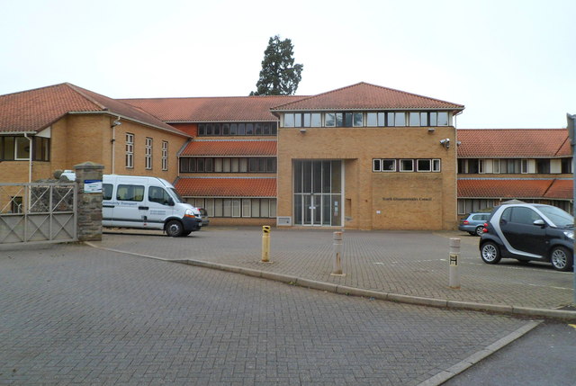
Image: © Jaggery Taken: 1 Jan 2012
Located on the corner of Castle Street and Stokefield Close, this is the administrative headquarters of South Gloucestershire Council. South Gloucestershire, a unitary district in the ceremonial county of Gloucestershire, was created in 1996, when the county of Avon was abolished. The former county's districts of Kingswood and Northavon were merged to form South Gloucestershire.
Images are licensed for reuse under creativecommons.org/licenses/by-sa/2.0
Image Location


Leaflet Map data © OpenStreetMap
Latitude
51.610792
Longitude
-2.528068