
Ruined tower on top of Dixon Heights, Newton Fell
Introduction
The photograph on this page of Ruined tower on top of Dixon Heights, Newton Fell by Karl and Ali as part of the Geograph project.
The Geograph project started in 2005 with the aim of publishing, organising and preserving representative images for every square kilometre of Great Britain, Ireland and the Isle of Man.

There are currently over 7.5m images from over 14,400 individuals and you can help contribute to the project by visiting https://www.geograph.org.uk
Ruined tower on top of Dixon Heights, Newton Fell
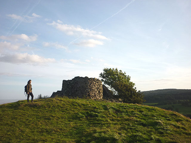
Image: © Karl and Ali Taken: 5 Sep 2012
A.Wainwright in his 'Outlying Fells' volume states that the tower was: 'habitable and used by the Home Guard during the last war. The origins and purpose of the tower are obscure. There is a legend that it was a lookout for the observation of smugglers in the estuary but it seems equally likely to have been merely a decoration of the Eller How estate, this theory being supported by the presence of other ornamental stonework in the vicinity.'. The Heights are now CRoW access land and accessible via public footpath. It is well worth the small exertion for the wide-ranging views.
Images are licensed for reuse under creativecommons.org/licenses/by-sa/2.0
Image Location

Latitude
54.226201
Longitude
-2.901112