Wilson Street
Introduction
The photograph on this page of Wilson Street by Alan Murray-Rust as part of the Geograph project.
The Geograph project started in 2005 with the aim of publishing, organising and preserving representative images for every square kilometre of Great Britain, Ireland and the Isle of Man.

There are currently over 7.5m images from over 14,400 individuals and you can help contribute to the project by visiting https://www.geograph.org.uk
Wilson Street
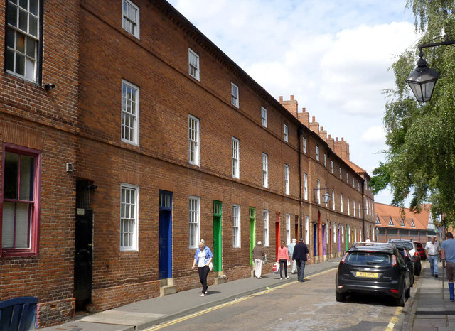
Image: © Alan Murray-Rust Taken: 31 Aug 2012
The street was conceived and developed as an entity in 1766 by Dr Bernard Wilson, then Vicar of Newark. The houses form a symmetrical unit with projecting taller blocks at each end and a centre projecting bay with an archway through to the rear of the buildings. The recent introduction of brightly coloured doors enhances the interest. Listed Grade II.
Images are licensed for reuse under creativecommons.org/licenses/by-sa/2.0
Image Location
Latitude
53.077349
Longitude
-0.808605