
Royal Observer Corps bunker, Traquair
Introduction
The photograph on this page of Royal Observer Corps bunker, Traquair by Jim Barton as part of the Geograph project.
The Geograph project started in 2005 with the aim of publishing, organising and preserving representative images for every square kilometre of Great Britain, Ireland and the Isle of Man.

There are currently over 7.5m images from over 14,400 individuals and you can help contribute to the project by visiting https://www.geograph.org.uk
Royal Observer Corps bunker, Traquair
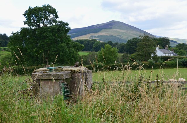
Image: © Jim Barton Taken: 30 Aug 2012
One of almost 1560 underground observation posts spaced about 8 miles apart from 1956 to 1962 for monitoring the extent and location of nuclear weapon strikes during the Cold War years. Each bunker was designed to house four men 12 feet below ground with food and water supplies sufficient to sustain them ‘in a state of bearable discomfort for one week.’ In the event of a nuclear strike the observers were to use simple instruments to estimate the direction and size of the bomb blast and report results by telephone to one of 29 Group Headquarters. (Source: ‘Cold War Secret Nuclear Bunkers’ by Nick McCamley, Pen & Sword Military Classics, Barnsley 2007.)
Images are licensed for reuse under creativecommons.org/licenses/by-sa/2.0
Image Location

Latitude
55.597388
Longitude
-3.068605