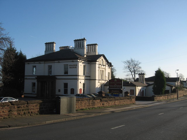
Grange Manor Public House, Gateacre
Introduction
The photograph on this page of Grange Manor Public House, Gateacre by Sue Adair as part of the Geograph project.
The Geograph project started in 2005 with the aim of publishing, organising and preserving representative images for every square kilometre of Great Britain, Ireland and the Isle of Man.
There are currently over 7.5m images from over 14,400 individuals and you can help contribute to the project by visiting https://www.geograph.org.uk

Image: © Sue Adair Taken: 14 Jan 2007
Grange Manor pub in Grange Lane, Gateacre. Grange Lane follows the line of an old packhorse trail, which led from the Mersey crossing at Hale to the township of West Derby in the days before Liverpool even existed. Originally called Gorsey Cop, the name originating from an Anglo-Saxon word meaning head or top, of a hill or rise covered in gorse. A farm of that name appeared on 1768 map and was there until the 1960's when the land was used for housing. The house itself was built between 1871-1881 for a wealthy gentleman, a rural retreat on high ground with superb views across the farmland and heathland to Huyton and Prescot. A Manchester cotton broker lived there in 1881, possibly the original occupant. The name Gorsey Cop was kept when it became a nightclub/casino around the 1960's but was changed to Grange Manor in more recent years.

