Former Clifton Moor station
Introduction
The photograph on this page of Former Clifton Moor station by Ben Brooksbank as part of the Geograph project.
The Geograph project started in 2005 with the aim of publishing, organising and preserving representative images for every square kilometre of Great Britain, Ireland and the Isle of Man.

There are currently over 7.5m images from over 14,400 individuals and you can help contribute to the project by visiting https://www.geograph.org.uk
Former Clifton Moor station
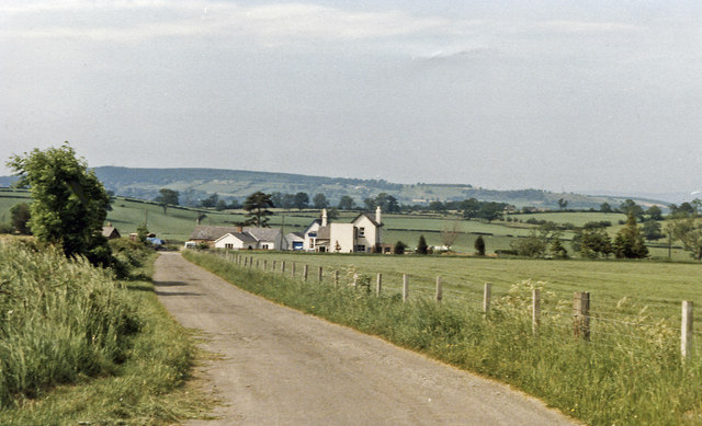
Image: © Ben Brooksbank Taken: 26 Jun 1986
View northward, along the road to the station, with Whinfell Forest (432 ft.) and Penrith Beacon (937 ft.) in the distance. The station (plain 'Clifton' until 9/27) was on the Eden Valley section of the ex-NER Stainmore Line from Darlington and Barnard Castle via Kirkby Stephen and closed from 22/1/62, to goods 6/7/64.
Images are licensed for reuse under creativecommons.org/licenses/by-sa/2.0
Image Location
Latitude
54.629197
Longitude
-2.71188