Sundridge House
Introduction
The photograph on this page of Sundridge House by Ian Capper as part of the Geograph project.
The Geograph project started in 2005 with the aim of publishing, organising and preserving representative images for every square kilometre of Great Britain, Ireland and the Isle of Man.

There are currently over 7.5m images from over 14,400 individuals and you can help contribute to the project by visiting https://www.geograph.org.uk
Sundridge House
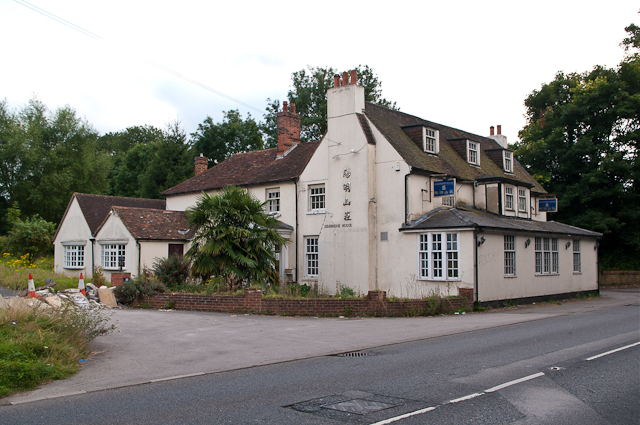
Image: © Ian Capper Taken: 22 Aug 2012
Former 19th century pub (known as the Lamb Inn), converted to offices around 1999 and then to a Chinese restaurant in around 2003. Following a decline in business leading to closure, the owner has applied to convert the building to a house (planning permission for which was granted in 2010), but further plans to develop the adjacent car park for housing have been refused, due to the green belt/conservation area/AONB status of the site. At the time of this photo, another proposal is being considered, namely the redevelopment of part of the building for residential use, with a second detached house behind, and with the car park area being landscaped as a garden, to maintain the openness of the site.
Images are licensed for reuse under creativecommons.org/licenses/by-sa/2.0
Image Location
Latitude
51.278655
Longitude
0.13032