Harbour Heights
Introduction
The photograph on this page of Harbour Heights by Simon Carey as part of the Geograph project.
The Geograph project started in 2005 with the aim of publishing, organising and preserving representative images for every square kilometre of Great Britain, Ireland and the Isle of Man.

There are currently over 7.5m images from over 14,400 individuals and you can help contribute to the project by visiting https://www.geograph.org.uk
Harbour Heights
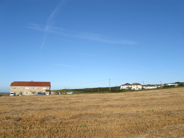
Image: © Simon Carey Taken: 31 Aug 2012
The cliffs west of Newhaven were opened to development after the First World War with the plots sold individually for those wishing to build their own homes next to newly laid out roads. A mixture of cost, lack of connection to basic utilities and the depression of the late 1920s resulted in a scattered development which was halted by the onset of war and stopped completely by the advent of tougher planning laws in 1947. To the left are Westdean and Lyndale the only two dwellings on Westdean Avenue whilst to the right are four further dwellings based around Cuckmere Road and Charleston Avenue.
Images are licensed for reuse under creativecommons.org/licenses/by-sa/2.0
Image Location
Latitude
50.783971
Longitude
0.034976