Pevensey Road, Harbour Heights
Introduction
The photograph on this page of Pevensey Road, Harbour Heights by Simon Carey as part of the Geograph project.
The Geograph project started in 2005 with the aim of publishing, organising and preserving representative images for every square kilometre of Great Britain, Ireland and the Isle of Man.

There are currently over 7.5m images from over 14,400 individuals and you can help contribute to the project by visiting https://www.geograph.org.uk
Pevensey Road, Harbour Heights
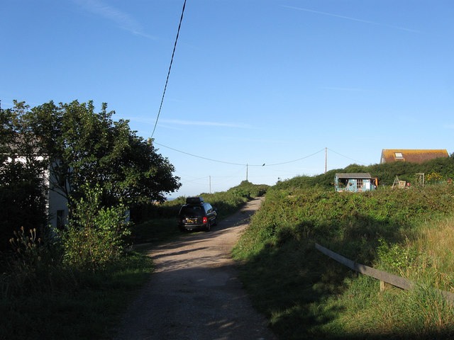
Image: © Simon Carey Taken: 31 Aug 2012
Unmade road that was laid out as part of the Harbour Heights development. The take up of plots was minimal and resulted in scattered dwellings along the roads that were laid out. The development was stopped in 1939 and never started after tougher planning laws were introduced in 1947. Four Winds is the house behind the tree to the left whilst the roof of Greenways is to the right.
Images are licensed for reuse under creativecommons.org/licenses/by-sa/2.0
Image Location
Latitude
50.786058
Longitude
0.033931