Former Christon Bank station, 1988
Introduction
The photograph on this page of Former Christon Bank station, 1988 by Ben Brooksbank as part of the Geograph project.
The Geograph project started in 2005 with the aim of publishing, organising and preserving representative images for every square kilometre of Great Britain, Ireland and the Isle of Man.

There are currently over 7.5m images from over 14,400 individuals and you can help contribute to the project by visiting https://www.geograph.org.uk
Former Christon Bank station, 1988
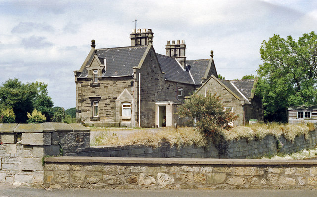
Image: © Ben Brooksbank Taken: 23 Jun 1988
View WNW from by the level-crossing of the B6347 over the ECML (Newcastle - Berwick-upon-Tweed section), towards Berwick and Edinburgh, the railway being out of sight on the left. It was one of several outstanding wayside stations built in 1847 for the Newcastle & Berwick Railway and since closed on 15/9/58 has been splendidly restored by private owners.
Images are licensed for reuse under creativecommons.org/licenses/by-sa/2.0
Image Location


Leaflet Map data © OpenStreetMap
Latitude
55.501221
Longitude
-1.664214