Inside Braunston Lock Number 2
Introduction
The photograph on this page of Inside Braunston Lock Number 2 by Stuart Logan as part of the Geograph project.
The Geograph project started in 2005 with the aim of publishing, organising and preserving representative images for every square kilometre of Great Britain, Ireland and the Isle of Man.

There are currently over 7.5m images from over 14,400 individuals and you can help contribute to the project by visiting https://www.geograph.org.uk
Inside Braunston Lock Number 2
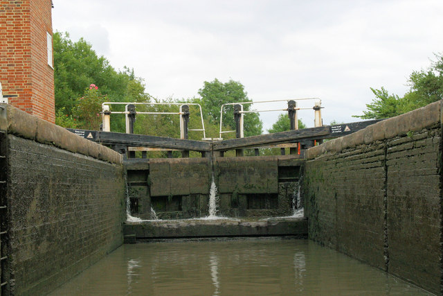
Image: © Stuart Logan Taken: 13 Aug 2012
The boat has just entered the lock through the open tail-gates (behind the viewer to the west). Currently the water level matches that of the pound to the west. There is room for two narrowboats in this broad lock. In front is a level cill onto which the head-gates shut and seal. Coming down the lock the stern of the boat must be kept clear of that cill otherwise the craft will be tipped bow downwards as the water level drops. However in this picture the boat is ascending, so when it is safely into the lock the tail gates can be closed and water let into the chamber. When the lock is full the head-gates are opened and the boat sails out into the next pound to the east.
Images are licensed for reuse under creativecommons.org/licenses/by-sa/2.0
Image Location


Leaflet Map data © OpenStreetMap
Latitude
52.289243
Longitude
-1.199764