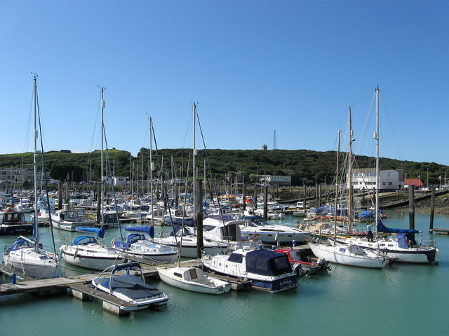
Sleeper's Hole
Introduction
The photograph on this page of Sleeper's Hole by Simon Carey as part of the Geograph project.
The Geograph project started in 2005 with the aim of publishing, organising and preserving representative images for every square kilometre of Great Britain, Ireland and the Isle of Man.
There are currently over 7.5m images from over 14,400 individuals and you can help contribute to the project by visiting https://www.geograph.org.uk

Image: © Simon Carey Taken: 26 Aug 2012
Originally an old channel of the River Ouse which meandered then turned eastwards. The western end was blocked in the 1770s and a small cove was formed providing a sheltered anchorage behind Castle Hill. The cove was later used as a place to submerge railway sleepers prior to their use on the tracks which could be an origin of its name. During the 1960s it was converted into a marina and is known as Newhave Marina today.

