Nant Bran River, Cwmhiraeth
Introduction
The photograph on this page of Nant Bran River, Cwmhiraeth by Alan Richards as part of the Geograph project.
The Geograph project started in 2005 with the aim of publishing, organising and preserving representative images for every square kilometre of Great Britain, Ireland and the Isle of Man.

There are currently over 7.5m images from over 14,400 individuals and you can help contribute to the project by visiting https://www.geograph.org.uk
Nant Bran River, Cwmhiraeth
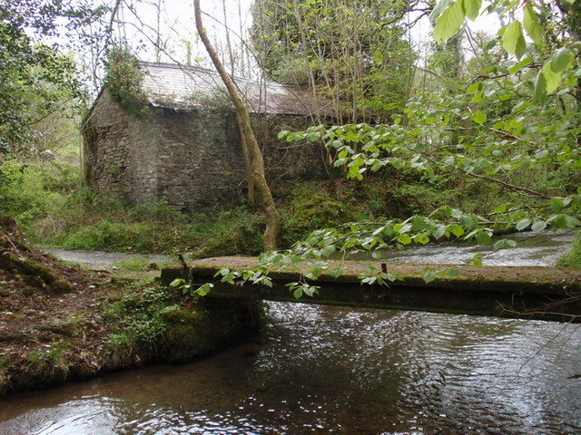
Image: © Alan Richards Taken: 18 May 2012
Pontroed yn rhychwantu Nant Bran yng Nghwmhiraeth. Mae'r heol sy'n rhydio'r afon yn arwain lan y tyle at Ffarm Pant yr Efail, man geni Griffith Jones, Llanddowror. Y bwthyn adfeiliedig yn y pellter yw Maes y Coed ('Banc yr On' gynt) A footbridge spanning the Bran River in Cwmhiraeth. The road which fords the stream leads up to Pant yr Efail Farm, the birthplace of Griffith Jones, Llanddowror. The dilapidated cottage in the distance is called Maes y Coed (formerly 'Banc yr On')
Images are licensed for reuse under creativecommons.org/licenses/by-sa/2.0
Image Location
Latitude
52.018794
Longitude
-4.418967