Former Royal Military Academy - SE18
Introduction
The photograph on this page of Former Royal Military Academy - SE18 by David Hallam-Jones as part of the Geograph project.
The Geograph project started in 2005 with the aim of publishing, organising and preserving representative images for every square kilometre of Great Britain, Ireland and the Isle of Man.

There are currently over 7.5m images from over 14,400 individuals and you can help contribute to the project by visiting https://www.geograph.org.uk
Former Royal Military Academy - SE18
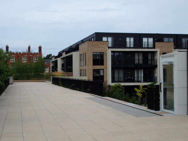
Image: © David Hallam-Jones Taken: 6 Aug 2012
The upper floors of the rear of Kitchener House from a pedestrianised area that the developers have named 'Southern Edge'. Ahead are the rear elevations of some of the apartments in one of the converted blocks that are still known as "West Cadets' Quarters". Behind the "West Cadets' Quarters" are the perimeter railings and Academy Road (a.k.a. the A205 or South Circular Rd). The glass-fronted door on the right is the entrance/exit door into a lift for the use of individuals moving between this level and "Village Square" level. Village Square is where the former church is located, a building that is to become a community arts and culture space.
Images are licensed for reuse under creativecommons.org/licenses/by-sa/2.0
Image Location
Latitude
51.474606
Longitude
0.05822