Probable site of Cerist 'station' on Van Railway, 1986
Introduction
The photograph on this page of Probable site of Cerist 'station' on Van Railway, 1986 by Ben Brooksbank as part of the Geograph project.
The Geograph project started in 2005 with the aim of publishing, organising and preserving representative images for every square kilometre of Great Britain, Ireland and the Isle of Man.

There are currently over 7.5m images from over 14,400 individuals and you can help contribute to the project by visiting https://www.geograph.org.uk
Probable site of Cerist 'station' on Van Railway, 1986
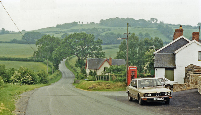
Image: © Ben Brooksbank Taken: 23 Jun 1986
View southward across Afon Cerist valley to Cern Carnedd (908 ft.). From August 1871 until finally closed in November 1940, a mineral railway ran from Caersws (to left) to Van (to right). Until about 1879 (!), it conveyed passengers and a Halt of sorts existed here at Cerist. (My more modern transport features outside the Post Office).
Images are licensed for reuse under creativecommons.org/licenses/by-sa/2.0
Image Location
Latitude
52.482281
Longitude
-3.528738