Former Military Academy - SE18
Introduction
The photograph on this page of Former Military Academy - SE18 by David Hallam-Jones as part of the Geograph project.
The Geograph project started in 2005 with the aim of publishing, organising and preserving representative images for every square kilometre of Great Britain, Ireland and the Isle of Man.

There are currently over 7.5m images from over 14,400 individuals and you can help contribute to the project by visiting https://www.geograph.org.uk
Former Military Academy - SE18
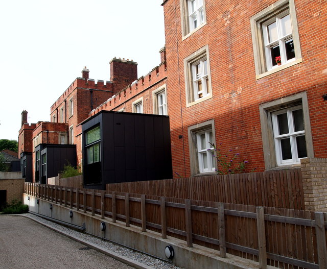
Image: © David Hallam-Jones Taken: 6 Aug 2012
This view of the rear of the redeveloped "West Cadets' Quarters" block show how the architects have added additional space to the ground floor accommodation by 'bolting on' these rectangular extension units. A utilities-related path can be seen sandwiched between the two wooden fences and in front of the fence nearest to the photographer is a driveway leading to the car park beneath a neighbouring apartment block. The front elevations of the "West Cadets' Quarters" face Well Hall Road (the A205) although there is a fair amount of open space between them and the perimeter railings.
Images are licensed for reuse under creativecommons.org/licenses/by-sa/2.0
Image Location
Latitude
51.474708
Longitude
0.057504