Three ways of travelling north of Chesterfield
Introduction
The photograph on this page of Three ways of travelling north of Chesterfield by Christine Johnstone as part of the Geograph project.
The Geograph project started in 2005 with the aim of publishing, organising and preserving representative images for every square kilometre of Great Britain, Ireland and the Isle of Man.

There are currently over 7.5m images from over 14,400 individuals and you can help contribute to the project by visiting https://www.geograph.org.uk
Three ways of travelling north of Chesterfield
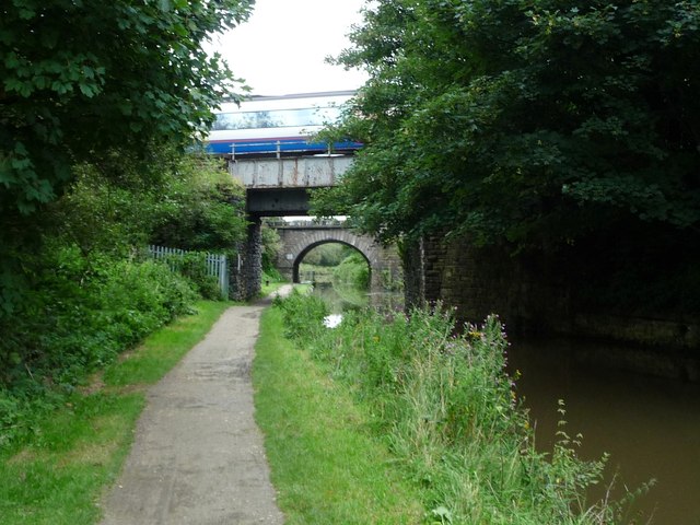
Image: © Christine Johnstone Taken: 27 Aug 2012
The Chesterfield Canal was built to carry freight by boat. It is crossed here by two railway lines [near to Sheffield, far to Rotherham] which carry passengers and freight. The canal towpath is now used by two long distance walking and cycling routes [Trans Pennine Trail and Cuckoo Way].
Images are licensed for reuse under creativecommons.org/licenses/by-sa/2.0
Image Location
Latitude
53.25395
Longitude
-1.420203