Dartford, Littlebrook Power Station - DA2
Introduction
The photograph on this page of Dartford, Littlebrook Power Station - DA2 by David Hallam-Jones as part of the Geograph project.
The Geograph project started in 2005 with the aim of publishing, organising and preserving representative images for every square kilometre of Great Britain, Ireland and the Isle of Man.

There are currently over 7.5m images from over 14,400 individuals and you can help contribute to the project by visiting https://www.geograph.org.uk
Dartford, Littlebrook Power Station - DA2
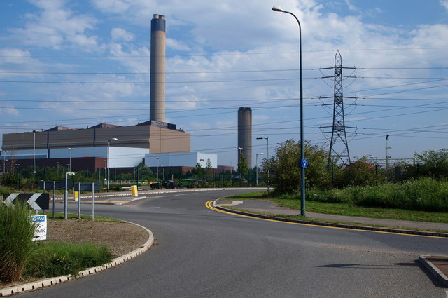
Image: © David Hallam-Jones Taken: 10 Aug 2012
The most active part of this four unit complex is apparently the "Littlebrook D" power station, with parts of Station A, B and C only partially in use. Although it is impossible for the uninformed observer to work out which is which this seems a more modern looking part of the overall site. I also saw a directional sign for "Long Reach Power Station" on a lamp post on this road but I didn't have time to investigate its whereabouts.
Images are licensed for reuse under creativecommons.org/licenses/by-sa/2.0
Image Location
Latitude
51.461481
Longitude
0.239454